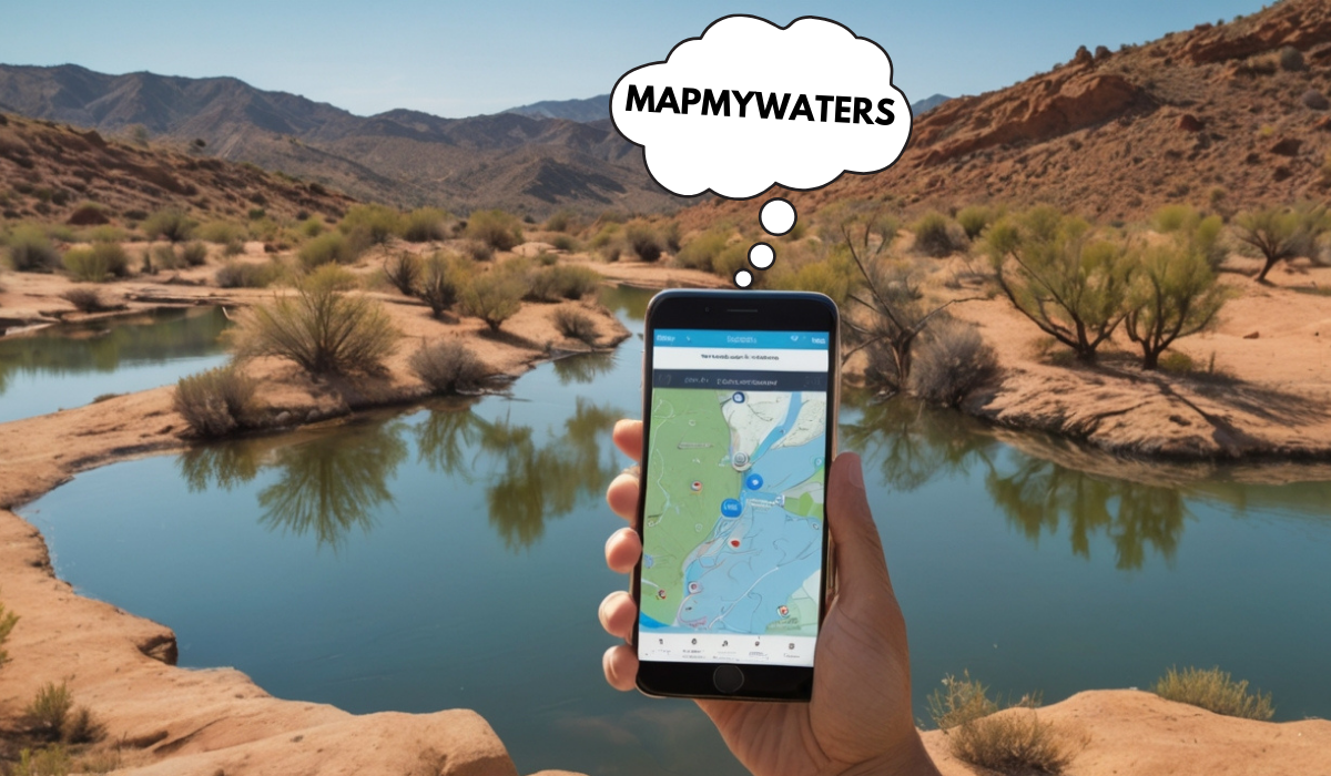
Revolutionizing Water Management with MapMyWaters
Introduction
Water management is not just a concern; it’s a global imperative. Whether it’s sustaining agricultural productivity, supporting industrial operations, or planning urban development, efficient water usage is vital for a sustainable future. Enter MapMyWaters, a revolutionary platform that combines cutting-edge technology to tackle some of the water industry’s biggest challenges.
By integrating real-time monitoring, data analytics, and Geographic Information Systems (GIS), MapMyWaters empowers industries, farmers, urban planners, and communities to make smarter, more sustainable water management decisions.
This blog explores how MapMyWaters works, its key features, its benefits across various sectors, and why it’s becoming indispensable for effective water management.
What is MapMyWaters?
MapMyWaters is a comprehensive water management platform that delivers real-time insights into water systems. It uses sensors, GIS, and data analytics to collate detailed information on water availability, consumption, and quality. This enables users to make informed decisions, optimize their water usage, and mitigate risks stemming from water scarcity.
The platform isn’t just a solution. It’s a blueprint for achieving sustainability across multiple sectors.
Applications of MapMyWaters
- Agriculture: Helps farmers allocate water resources more effectively to sustain yields while reducing waste.
- Urban Development: Supports city planners in designing more innovative water supply systems by understanding resource availability.
- Industry: Optimizes water use across manufacturing, energy production, and resource-heavy industries.
- Environment: Tracks water quality and hydrological changes for ecological conservation efforts.
Key Features of MapMyWaters
A. Real-Time Water Monitoring
One of MapMyWaters’s standout features is its ability to provide real-time updates on water levels and quality. Sensors installed in irrigation systems, reservoirs, and urban infrastructure feed live data into the platform.
These real-time insights allow businesses, farmers, and municipalities to respond quickly to leaks, shortages, or contamination, minimizing losses and ensuring effective allocation.
Key benefits of real-time monitoring include:
- Tracking usage patterns over time.
- Immediate detection of inefficiencies or anomalies.
- Quick response to emergencies.
B. Advanced Analytics for Smarter Decisions
It provides raw data but also does not add context. The platform’s analytics feature crunches historical data trends, usage patterns, and predictive modeling to deliver actionable insights. Whether you’re evaluating the effectiveness of current water policies or planning for seasonal demand changes, MapMyWaters simplifies decision-making.
You can rely on analytics for:
- Identifying inefficiencies and optimizing water flow.
- Forecasting future water demands.
- Developing data-driven conservation strategies.
C. Water Quality Monitoring
Ensuring that water meets required quality standards is critical, especially in water-heavy sectors like healthcare and agriculture. It monitors essential indicators like pH, temperature, and potential contaminants.
Features include:
- Quality score mapping across water systems.
- Alerts for potential contamination.
- Historical quality data to evaluate long-term trends.
D. GIS and Geospatial Analysis
MapMyWaters leverages GIS technology to provide geospatial insights into water resource distribution. With interactive maps and intuitive visualizations, users clearly understand where water is concentrated and how levels fluctuate over time.
Use cases for GIS analysis include:
- Farmers analyzing rain-fed zones vs. drought-prone areas.
- Utility companies identify infrastructure vulnerabilities.
- Urban planners optimize the design of water distribution systems.
E. Sustainability-Focused Design
It is built with sustainability in mind. Beyond operational efficiency, it equips organizations with tools to minimize environmental impacts by promoting conservation efforts and reducing unnecessary water waste.
How MapMyWaters Creates Value Across Sectors
1. Agriculture
Farmers often face the dual challenge of boosting productivity while conserving water. MapMyWaters enables precision irrigation, helping farmers deliver the right amount of water where it’s most needed.
Benefits for agriculture include:
- Avoiding overwatering and preserving groundwater reservoirs.
- Boosting crop yields with data-backed irrigation techniques.
- Monitoring soil moisture for optimal results.
2. Urban Water Management
Cities worldwide face increasing challenges in meeting water demands. It clarifies resource availability and demand trends, enabling municipalities to plan better.
Key contributions include:
- Preventing supply shortages through predictive analytics.
- Mapping water delivery routes for better distribution.
- Monitoring municipal water quality to meet safety standards.
3. Manufacturing and Industry
Water-intensive industries benefit significantly from the insights provided by MapMyWaters. Whether using water more efficiently or meeting environmental sustainability targets, this tool ensures industries remain productive without compromising the ecosystem.
Industrial applications include:
- Reducing water waste during manufacturing.
- Monitoring industrial discharge to meet legal compliance.
- Custom reports to align with corporate sustainability goals.
4. Environmental Conservation
By tracking the health of rivers, lakes, and groundwater, It empowers conservationists to make impactful decisions.
Key contributions include:
- Preventing contamination of natural water bodies.
- Monitoring ecological shifts in hydrological systems.
- Identifying regions prone to water stress or drought.
The Future of Sustainable Water Management with MapMyWaters
Water is rapidly becoming one of the most critical resources in global sustainability efforts. Platforms like MapMyWaters simplify complex challenges by integrating technology that turns data into actionable insights.
Whether you’re monitoring water quality in a rural community or optimizing supply chains for a multinational corporation, It offers tools for everyone. Its intelligent design meets today’s demands and equips users to address tomorrow’s challenges.
Why Choose MapMyWaters?
The following benefits make mapmywaters a game-changer in water management efforts.
A. For Everyday Users
- Save Resources: Reduce water wastage and costs by tracking consumption in real-time.
- Easy to Use: Intuitive features make it accessible to users without technical knowledge.
- Health and Safety First: Monitor water quality to safeguard yourself and your family.
B. For Organizations and Industries
- Sustainability Leadership: Adopt eco-friendly practices by conserving water resources.
- Measurable Results: Evaluate success through data-backed insights.
- Compliance Made Easy: Stay ahead of legal and regulatory requirements.
C. For Governments and Policymakers
Public Health: Ensure safe drinking water for citizens.
Efficient Allocation: Distribute water to underserved communities through better planning.
Disaster Management: Use predictive data to prepare for water-related events like floods or droughts.
Emerging Technologies Backing MapMyWaters
Innovation propels It as it integrates cutting-edge technologies like:
- IoT-Enabled Sensors for accurate, real-time data capture.
- Machine Learning Algorithms for predictive analytics and trend forecasting.
- Satellite Imagery for large-scale geospatial analysis of water bodies.
This tech-forward approach ensures precise decision-making while enhancing usability across all levels.
FAQs
Q1. How can MapMyWaters benefit farmers specifically?
A. Farmers can use MapMyWaters for smart irrigation, precision technology, and soil moisture insights to save water and increase crop productivity.
Q2. Is MapMyWaters suitable only for small businesses or large organizations?
A. MapMyWaters is highly scalable, catering to farms, local municipalities, NGOs, and multinational corporations.
Q3. What kind of data does MapMyWaters require to function?
A. The platform pulls real-time sensor data, GIS insights, and historical usage trends, allowing users to customize its application based on their needs.
Q4. Can MapMyWaters predict water shortages?
A. Yes, its predictive analytics feature evaluates historical trends, weather data, and usage patterns to forecast shortages and optimize resources accordingly.


Post Comment